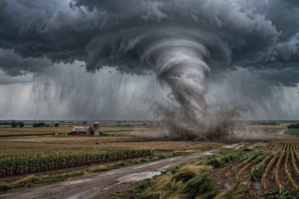
How Do Tornadoes Form in the Midwest? The Complete Science
Every spring, the same atmospheric collision plays out over the American Midwest: warm, humid air streaming north from the Gulf of Mexico slams into cold, dry air plunging south from Canada — and the battleground is the Great Plains and Midwest. The result is the most violent weather on Earth: tornadoes, with winds that can exceed 300 mph, carving paths of destruction through towns that had twenty minutes of warning, or none.
But why here? Why does the Midwest — uniquely on the planet — produce the world’s most frequent and most violent tornadoes? The answer is a precise recipe of geography, jet stream dynamics, and thermodynamics that exists almost nowhere else. This guide explains the full formation sequence, why the Midwest is ground zero, and what the science says about staying safe.
The Ingredients: What a Tornado Needs
Tornadoes are born from supercell thunderstorms — the rotating monsters that are themselves rare outside the central U.S. A supercell needs four ingredients colliding at once:
1. Warm, moist surface air. The Gulf of Mexico acts as a giant moisture pump, sending 70°F+ dew-point air northward across Texas, Oklahoma, Kansas, and into the Midwest. This warm sector is the fuel — the energy source for the entire storm.
2. Cold, dry air aloft. Meanwhile, the jet stream drags cold Canadian air and dry air from the Rockies over the top of that warm layer. Warm air below, cold air above: the atmosphere becomes violently unstable, like a pot of water with the burner on high.
3. Wind shear. This is the secret ingredient. Wind shear — winds changing speed and direction with height — gives the storm its spin. Near the surface, winds blow from the south; a few thousand feet up, from the southwest and faster; higher still, from the west faster yet. This directional turning with height creates horizontal rolling motion in the atmosphere — an invisible rolling pin of air.
4. A trigger. A cold front, a dryline (the boundary between moist Gulf air and dry desert air), or outflow from another storm provides the lift that punches warm surface air upward through the unstable layer, starting the updraft.
The Formation Sequence: From Shear to Funnel
Step 1: The updraft tilts the shear. When the trigger lifts warm air, the rising updraft grabs that horizontally rolling air and tilts it vertical — like lifting one end of a rolling pin. Now the storm has a rotating updraft: a mesocyclone, 2-6 miles wide, spinning inside the supercell. Radar detects this rotation — it is what the National Weather Service watches for on NWS Doppler displays.
Step 2: The mesocyclone tightens. As the updraft intensifies, conservation of angular momentum (the figure-skater effect) spins the rotation faster and narrower. A rear-flank downdraft — cold air wrapping around the back of the storm — helps focus the rotation downward.
Step 3: The funnel descends. A rotating funnel cloud extends downward from the storm’s base. It becomes a tornado the moment it touches the ground (or debris cloud, which is the practical definition — a rain-wrapped tornado may never show a visible funnel).
Step 4: Intensification and dissipation. The tornado is fed by the pressure difference between the storm and the surface — the tighter the pressure drop, the more violent the winds. Most tornadoes last under 10 minutes and travel a few miles; the monsters — EF4 and EF5 — can grind on for an hour and 50+ miles. Eventually the downdraft chokes off the warm inflow and the tornado ropes out and dies.
The Enhanced Fujita Scale
Tornado strength is rated after the fact by damage, on the EF scale from EF0 (65-85 mph, light damage) to EF5 (over 200 mph, incredible damage — homes swept clean off foundations). About 70 percent of tornadoes are EF0-EF1; EF4-EF5 monsters are under 2 percent but cause the majority of deaths. The rating describes what the tornado did, inferred from damage — which is why a violent tornado over open farmland may be “underrated”: nothing there to destroy.
Why the Midwest? Geography’s Perfect Storm
No other place on Earth combines the ingredients this reliably. The geography is almost engineered for tornadoes: the Gulf of Mexico sits directly south, an endless moisture source with no mountain barrier. The Rocky Mountains to the west shape the jet stream into dips and create the dryline. Canada sits directly north, supplying cold air masses. And critically, there are no east-west mountain ranges in the central U.S. — unlike Europe or Asia, where mountains block the air-mass collisions. The flat corridor from Texas to the Dakotas is an open arena where tropical and polar air meet head-on, repeatedly, every spring.
The seasonal timing follows the jet stream: spring is peak season because the jet is still strong (cold air aloft) while Gulf moisture is surging (warm fuel below). By midsummer the jet retreats north and tornado activity shifts to the northern Plains; fall brings a secondary, smaller peak. Dixie Alley (the Southeast) gets a winter-spring peak with deadlier nocturnal tornadoes — a different and in some ways more dangerous regime.
Detection, Warning, and What To Do
Watch vs. warning. A tornado watch means conditions are favorable — stay alert. A tornado warning means one is occurring or imminent — act now. The average lead time for warnings is about 13 minutes, though it ranges from zero to over 30.
Where to go. The safest place is underground (basement, storm cellar) or an interior room on the lowest floor, away from windows, under something sturdy. Mobile homes are death traps in tornadoes — residents must have a plan to reach sturdier shelter. Contrary to old advice, highway overpasses are not shelter — wind accelerates under them and debris funnels through.
After the storm. Watch for downed power lines, gas leaks, and structural damage. Check on neighbors. And if storms left your home damp, address basement moisture after heavy rain quickly — mold follows water within 48 hours. For families riding out severe weather seasons with kids home from school, our rainy-day activities for teenagers help fill the long indoor hours.
NOAA’s Storm Prediction Center issues the daily convective outlooks that forecast tornado risk days in advance — the single best resource for planning around severe weather season.
Climate Change and Tornadoes: What We Know
The honest scientific answer is nuanced. There is no clear trend in overall U.S. tornado counts, but there are detectable shifts: tornado activity is clustering more (fewer tornado days, but more tornadoes on the big days), the geographic center is drifting eastward from the Plains toward the Southeast/Midwest, and the season is showing signs of shifting earlier. Whether warming will increase violent tornadoes remains an open research question — the physics cuts both ways (more moisture and instability, but potentially less wind shear). The research frontier, not the settled file.
Conclusion
Midwest tornadoes are the product of a unique geographic recipe: Gulf moisture, Canadian cold, Rocky Mountain-shaped jet streams, and an open flat corridor where they collide with violent wind shear. Understanding the formation sequence — shear tilted by updrafts, tightened by angular momentum, focused by downdrafts — will not stop a tornado, but it explains why the sirens sound here more than anywhere on Earth, and why the watch-versus-warning distinction deserves your full attention every spring.
Frequently Asked Questions
How do tornadoes form?
Wind shear creates horizontal rotation in the atmosphere; a supercell thunderstorm’s updraft tilts it vertical, forming a rotating mesocyclone; downdrafts focus the rotation downward until a funnel touches ground. All four ingredients — moisture, instability, shear, and a trigger — must coincide.
Why does the Midwest get so many tornadoes?
Unique geography: the Gulf of Mexico supplies warm moisture from the south, Canada supplies cold air from the north, the Rockies shape the jet stream, and no east-west mountains block the collision. The flat central corridor lets tropical and polar air masses meet repeatedly.
What is the difference between a tornado watch and warning?
A watch means conditions are favorable for tornadoes — stay alert. A warning means a tornado is occurring or imminent — take shelter immediately. Average warning lead time is about 13 minutes.
Where is the safest place during a tornado?
Underground (basement or storm cellar) or an interior room on the lowest floor, away from windows, under sturdy cover. Mobile homes offer no protection — have a plan to reach sturdier shelter. Never shelter under highway overpasses.
Are tornadoes getting worse with climate change?
Overall counts show no clear trend, but researchers observe clustering (more tornadoes on fewer days), an eastward geographic shift, and possible seasonal shifts. Whether warming increases violent tornado frequency remains an open question.