Why Is the Midwest Called Tornado Alley? Full Origin Story
“Tornado Alley” is one of those phrases everyone knows and almost no one can define precisely. Ask ten meteorologists where it is and you will get ten overlapping-but-different maps. Ask where the name came from and most people shrug. Yet the term shapes everything from insurance rates to storm-chaser tourism to where families think twice about buying a house.
This is the full story: where the name came from, what region it actually describes, the meteorology that earned it, how the “alley” is shifting east — and why some scientists wish we would retire the phrase entirely.
Where the Name Came From
The term was popularized — possibly coined — in 1952 by Air Force meteorologists Major Ernest J. Fawbush and Captain Robert C. Miller, who were tasked with forecasting tornadoes for Tinker Air Force Base in Oklahoma. Studying outbreak patterns, they noticed tornadoes clustering in a corridor from Texas through Oklahoma, Kansas, and Nebraska. Their internal reports and subsequent media coverage used “Tornado Alley,” and the phrase stuck — helped enormously by the fact that it sounds like an official designation even though no scientific body has ever formally defined it.
The media ran with it through the latter 20th century: every spring outbreak story referenced Tornado Alley, every documentary map drew the red zone, and the term entered the cultural lexicon alongside “Bible Belt” and “Rust Belt” — vivid, unofficial, and oddly authoritative-sounding.
What Region It Describes (Approximately)
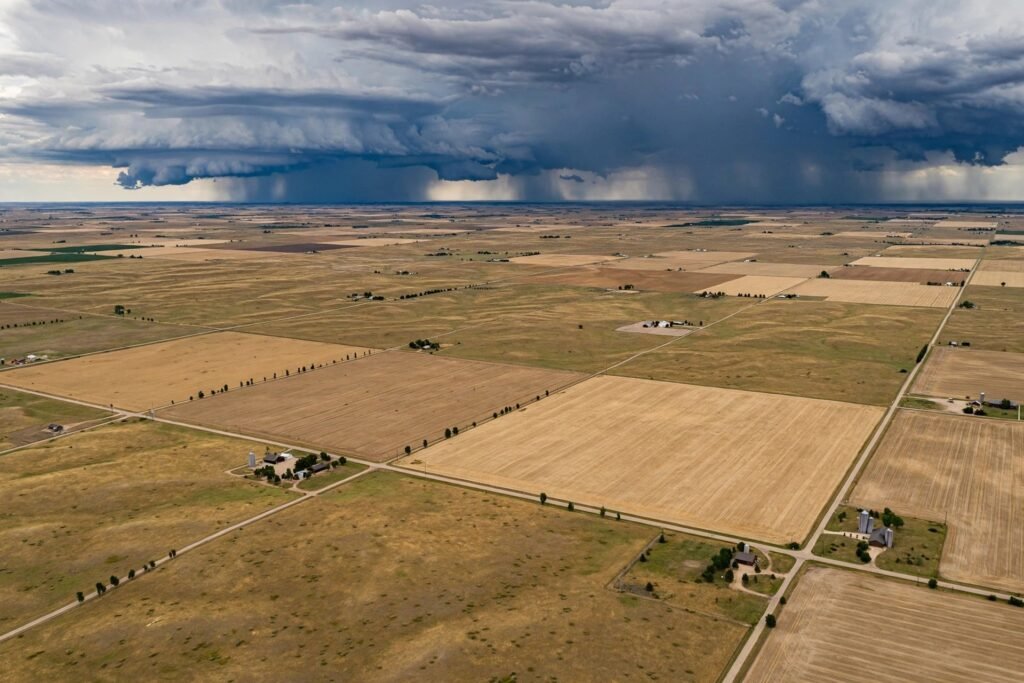
The classic definition covers the Great Plains core: Texas, Oklahoma, Kansas, and Nebraska, with extensions into eastern Colorado, South Dakota, Iowa, Missouri, and western Illinois depending on who is drawing the map. This is the region of maximum tornado frequency — the most tornadoes per square mile — and historically the home of the most violent tornadoes, the EF4 and EF5 monsters that level entire neighborhoods.
But frequency and risk are different things, and the map changes depending on which you plot. Oklahoma and Kansas lead in tornadoes per square mile. Texas leads in total count (it is enormous). And the deadliest tornado region — measured in fatalities — has always tilted southeast, toward what researchers call Dixie Alley: Mississippi, Alabama, Tennessee, and Arkansas, where tornadoes strike more often at night, in hilly tree-covered terrain that hides them, among more vulnerable housing and denser populations.
The Meteorology Behind the Alley
The classic alley exists for the same geographic reasons tornadoes favor the central U.S.: Gulf moisture streaming north unimpeded, Canadian cold plunging south, the Rockies shaping the jet stream and dryline, and no east-west mountain ranges to block the collision. The southern Plains maximize the overlap of these ingredients in spring — warm enough for instability, far enough north for strong jet-stream shear. Spring storm season also means long indoor stretches — see what to do on a rainy weekend at home for riding them out.
The Alley Is Moving East
Here is where the story gets interesting — and where the term starts to fail. Peer-reviewed research over the past decade documents a measurable eastward shift: tornado frequency is decreasing in the traditional western Plains alley and increasing in the Southeast and Midwest — roughly from Oklahoma and Texas toward Mississippi, Alabama, Tennessee, Illinois, and Indiana.
A landmark 2018 study by Gensini and Brooks found the centroid of tornado activity shifting eastward, with the most significant increases in the Mid-South. Possible drivers include shifting jet-stream patterns, changing Gulf moisture transport, and evolving land-surface conditions — though attribution to climate change specifically remains active research rather than settled conclusion. What is settled: the map is not static, and a term coined for 1950s Oklahoma increasingly misdescribes 2020s tornado geography.
This shift matters practically, not just academically. The eastern regions gaining tornado activity have higher population density, more hills and trees (reducing visibility and warning effectiveness), more nocturnal tornadoes, and more manufactured housing — a combination that makes the same tornado deadlier than in the open Plains. Emergency managers across the Southeast have spent the last decade adapting warning strategies designed for Kansas to the realities of Mississippi.
Why Scientists Debate the Term
A growing chorus of meteorologists argues “Tornado Alley” does more harm than good:
It implies false precision. There is no boundary, no official map — but the public treats the red zone on TV graphics as a real line, and people outside it underestimate their risk. Some of the deadliest tornadoes in American history struck far outside any version of the alley.
It obscures Dixie Alley’s danger. The Southeast’s tornado threat — nocturnal, rain-wrapped, fast-moving, striking vulnerable communities — kills more people per tornado than the Plains’ threat. A single “alley” centered on Oklahoma implicitly downgrades the region where tornadoes are actually deadliest.
It is frozen in time. As activity shifts east, the term anchors public understanding to a mid-20th-century map. Proposed replacements — “tornado alleys” (plural), or simply describing risk probabilistically — have not caught on, because “Tornado Alley” is too good a phrase to kill.
The National Weather Service itself avoids the term in official products, preferring precise geographic risk descriptions. But forecasters know the public thinks in “alley” terms, and risk communication has to meet people where they are.
What It Means for You (Wherever You Live)
The practical takeaway is not cartographic — it is behavioral. Tornado risk exists across roughly two-thirds of the continental U.S., and the deadliest tornado is the one you did not prepare for because “we’re not in Tornado Alley.”
Know your local climatology. Check your NWS forecast office’s tornado climatology page — every office publishes local statistics on peak season, typical timing (day vs. night), and historical tracks. Your county’s hazard mitigation plan has the same data.
Prepare for your region’s version. Plains residents: daylight, visible, long-track tornadoes with good warning lead times — basements and interior rooms suffice. Southeast and Midwest residents: faster onset, nocturnal risk, rain-wrapped tornadoes — which means NOAA weather radios (which wake you at 2 a.m.), helmets for head protection, and community shelters matter more.
Insurance reality check. Standard homeowners policies cover tornado wind damage in all states, but deductibles (especially separate “wind/hail” deductibles common in Plains states) and replacement-cost versus actual-cash-value details determine what a claim actually pays. Review yours before storm season, not after.
After major storms, secondary damage compounds fast — if your home takes on water, our guide to basement moisture after heavy rain covers the critical first 48 hours. And for keeping kids occupied during the long severe-weather days home from school, see our indoor activities for kids roundup.
For authoritative forecasting, NOAA’s Storm Prediction Center publishes daily severe weather outlooks, and your local National Weather Service office issues the watches and warnings that save lives.
Conclusion
The Midwest is called Tornado Alley because 1950s Air Force meteorologists needed a name for the corridor where Gulf moisture, Canadian cold, and Plains wind shear collided most violently — and the name was too vivid to die. It described a real phenomenon, but it was never official, never precise, and it is increasingly outdated as tornado activity shifts east into regions where tornadoes kill more efficiently. Keep the phrase for the history; lose it for your safety planning. Tornadoes do not read maps — prepare for the risk where you actually live.
Frequently Asked Questions
Who coined the term “Tornado Alley”?
Air Force meteorologists Ernest Fawbush and Robert Miller popularized it in 1952 while forecasting for Tinker Air Force Base in Oklahoma. No scientific body has ever formally defined the region’s boundaries.
Which states are in Tornado Alley?
The classic definition centers on Texas, Oklahoma, Kansas, and Nebraska, with extensions into surrounding Plains states. But boundaries are unofficial and vary by source — and tornado activity is measurably shifting eastward.
What is Dixie Alley?
The Southeast’s tornado region (Mississippi, Alabama, Tennessee, Arkansas and surroundings), where tornadoes are often nocturnal, rain-wrapped, and strike more vulnerable communities — making them deadlier per event than Plains tornadoes.
Is Tornado Alley moving?
Research shows tornado frequency decreasing in the western Plains and increasing in the Southeast and Midwest — an eastward shift documented in peer-reviewed studies, though the causes remain under investigation.
Does homeowners insurance cover tornado damage?
Yes — standard policies cover tornado wind damage in all states. Check your deductible structure (separate wind/hail deductibles are common) and whether your policy pays replacement cost or actual cash value before storm season.