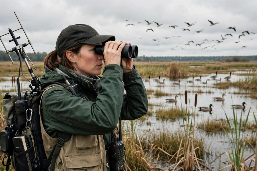
How Do Scientists Track Bird Migration Patterns? 5 Methods
Twice a year, billions of birds undertake journeys that defy comprehension: Arctic terns flying pole to pole — 50,000 miles annually, the longest migration on Earth. Blackpoll warblers launching off the New England coast and flying 88 hours nonstop over open ocean. Bar-tailed godwits crossing the entire Pacific in a single 7,000-mile flight without landing. For centuries, these movements were pure mystery — birds vanished in autumn and reappeared in spring, and nobody knew where they went.
Today, scientists track migrations with an arsenal of technologies, from century-old aluminum leg bands to satellite tags weighing less than a paperclip. This is how researchers follow birds across hemispheres — and what the tracking has revealed about navigation, survival, and a changing climate.
Method 1: Bird Banding (The Century-Old Foundation)
Since 1909, the U.S. Geological Survey’s Bird Banding Laboratory has coordinated the banding of wild birds: a lightweight aluminum band with a unique number is fitted around a bird’s leg, and if the bird is recaptured or found later, the recovery reveals its movements. Over 70 million birds have been banded in North America.
Banding’s strength is longevity and scale — a century of data, millions of records. Its weakness is the recovery rate: for most songbirds, under 1 percent of banded birds are ever encountered again. Banding tells us where birds can go, not the routes they take getting there. But for waterfowl — heavily hunted and frequently recovered — banding built the entire science of flyway management, defining the four North American flyways (Atlantic, Mississippi, Central, Pacific) that still structure conservation policy.
Method 2: Geolocators (Light-Level Logging)
The revolution for small birds came with archival geolocators — tiny devices (under a gram) attached to a leg band or backpack harness that simply record light levels against an internal clock. Dawn and dusk times reveal longitude; day length reveals latitude. Researchers recapture the bird a year later, download the data, and reconstruct its entire annual journey.
Geolocators exposed migrations nobody suspected: purple martins from the eastern U.S. wintering deep in the Amazon basin, veeries making looping detours around the Gulf, blackpoll warblers’ astonishing transoceanic flight confirmed with hard data. The trade-offs: precision is coarse (±100 miles), latitude fails near the equinoxes (equal day length everywhere), and you must recapture the bird — fine for site-faithful species, useless for others.
Method 3: Satellite and GPS Tags (Real-Time Tracking)
For larger birds, modern tags are transformative. Argos satellite tags transmit locations via satellite — no recapture needed — tracking eagles, storks, and waterfowl across continents in near real time. GPS tags offer precision down to meters, revealing not just routes but stopover habitat use, flight altitudes, and even foraging behavior.
Miniaturization keeps pushing the boundary downward: tags under 5 grams now track songbirds, following the ethical rule that tags stay below 3-5 percent of body weight. Solar-powered tags on large birds can transmit for years, building multi-annual life histories of individuals — migration timing, breeding success, wintering site fidelity, all from one bird.
The discoveries have rewritten textbooks: golden eagles riding specific thermal corridors, ospreys navigating around the Sahara via narrow bottlenecks, godwits’ nonstop Pacific crossing timed to exploit tailwinds. Each tracked bird is a data point; thousands of tracked birds are a new science of movement ecology.
Method 4: Motus Wildlife Tracking System
The Motus network — hundreds of automated radio-telemetry towers across the Americas — detects nanotags (tiny radio transmitters, 0.2 grams and up) as tagged animals pass within range. Unlike geolocators, Motus needs no recapture and no satellite subscription; unlike satellite tags, the tags are cheap enough for mass deployment on songbirds, bats, and even large insects.
Motus excels at revealing stopover ecology — where birds rest and refuel, how long they stay, and which habitats are critical links in the chain. Conservation follows directly: protecting a breeding ground means little if the stopover wetland halfway along the route is drained. Motus data has already reshaped habitat protection priorities across the hemisphere.
Method 5: Radar, Acoustics, and Citizen Science
Weather radar turns out to be a bird-tracking instrument: NEXRAD stations detect the nightly exodus of migrating birds as biological echoes. Researchers now quantify entire migration waves — billions of birds — from radar archives, mapping continental migration intensity night by night, year by year. It is how we know migration traffic has declined ~14 percent since 2007 in some flyways.
Acoustic monitoring captures nocturnal flight calls — most songbirds migrate at night, calling to stay in flock contact. Automated recorders and AI identification now census the invisible river of birds overhead while cities sleep.
Citizen science — eBird’s hundreds of millions of observations — provides the occurrence data that anchors everything else. The birder logging warblers at a local park is contributing to the same science as the satellite tag, at continental scale.
What Tracking Revealed: Navigation and Threats
How birds navigate remains partly mysterious, but tracking plus lab work has exposed a multi-sense system: a sun compass (calibrated by polarized light), a star compass (learned, not innate), magnetoreception (iron-based receptors in the beak, quantum effects in the eye’s cryptochrome proteins), olfactory maps, and possibly infrasound. Young birds on their first migration follow an inherited vector program — direction plus duration — then refine it with experience. The precision is staggering: Manx shearwaters return to the same burrow after 8,000-mile foraging trips.
The threats tracking exposed: light pollution disorients nocturnal migrants (one Chicago building’s lights killed ~1,000 birds in a single 2023 night), glass collisions kill up to a billion U.S. birds yearly, stopover habitat loss breaks the refueling chain, and climate change is decoupling migration timing from food peaks — birds arrive to find the insect emergence they evolved to meet has already passed (“phenological mismatch”). Tracking data quantifies each threat and targets the fixes: lights-out programs, bird-safe glass, stopover conservation.
Anyone can contribute: eBird (via Audubon) turns casual birding into science, and the USGS Bird Banding Lab accepts recovery reports from anyone who finds a banded bird. Even free birding outings double as data collection — and making your yard more welcoming with budget-friendly native plantings creates the stopover habitat migrants desperately need.
Conclusion
Scientists track bird migration with a layered toolkit: century-old banding for baseline data, geolocators for small-bird routes, satellite and GPS tags for real-time precision, the Motus tower network for stopover ecology, and radar, acoustics, and citizen science for continental-scale patterns. Together they have revealed migrations of staggering ambition — and threats of matching scale. The birds are telling us, night after night, exactly what they need. The tracking means we no longer have the excuse of not knowing.
Frequently Asked Questions
How do scientists track small migrating birds?
Primarily with geolocators (light-level loggers, ~1g, requiring recapture), Motus nanotags (detected by automated tower networks, no recapture needed), and increasingly miniaturized GPS tags. Traditional leg banding provides long-term baseline data.
How do birds know where to migrate?
A multi-sense navigation system: sun compass, learned star compass, magnetic field detection (magnetite receptors and quantum effects in eye proteins), smell, and possibly infrasound. First-year birds follow an inherited direction-and-duration program, refined with experience.
What is the longest bird migration?
The Arctic tern: pole-to-pole, roughly 50,000 miles annually. The longest nonstop flight belongs to the bar-tailed godwit — ~7,000 miles across the Pacific without landing.
What is the Motus wildlife tracking system?
A network of automated radio-telemetry towers across the Americas that detect tiny nanotags on birds, bats, and insects as they pass. It reveals migration routes and stopover habitat use without requiring recapture or satellite subscriptions.
How can I help track bird migration?
Submit observations to eBird, report banded birds to the USGS Bird Banding Lab, participate in acoustic monitoring projects, and reduce local threats: turn off unnecessary lights during migration seasons and make windows bird-safe.